Plizio Visual Lab
Curepipe
ℹ️Practical info — Curepipe
▾
🌤 Weather — 5 days
📍 Nearby
Sights nearby
💡 Tips
- Bring a light jacket or umbrella, as Curepipe's high elevation makes it cooler and rainier than the coast.
- The best time to visit the Trou aux Cerfs crater is early morning for clear views before the clouds roll in.
- Traffic in the town center can be heavy; parking near the bus terminal is usually easier.
- Enjoy a warm cup of local tea, a common local way to beat the cooler mountain climate.
🍽 Food
Try these boiled noodles at a street food stall near the central bus station.
Buy these chili bites fresh and hot from vendors in the local market.
Warm up with a cup at a downtown café.
🛍 Shopping · 🧘 Quiet spots
Great for fresh produce, local spices, and experiencing the daily hustle.
Look for specialized shops in the town center selling highly detailed, handcrafted wooden ship models.
Take a peaceful walk around the dormant volcano crater for panoramic island views.
A calm, historic garden excellent for a quiet stroll away from the town's traffic.
Water temperature…
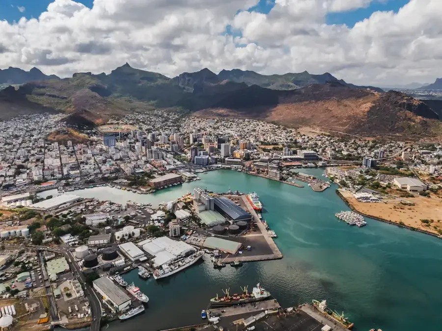
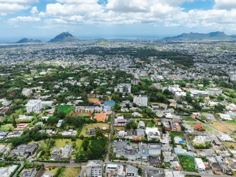
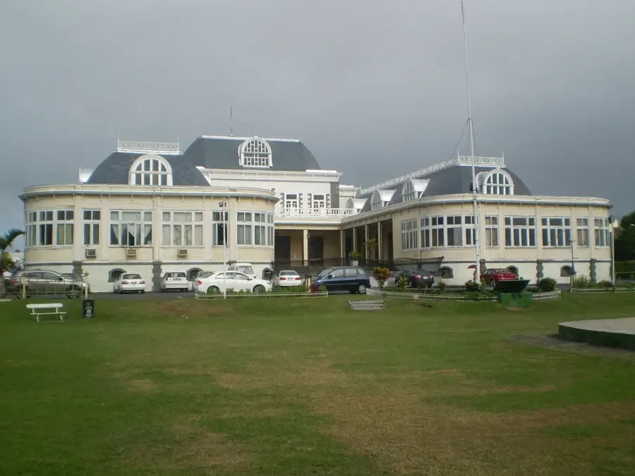
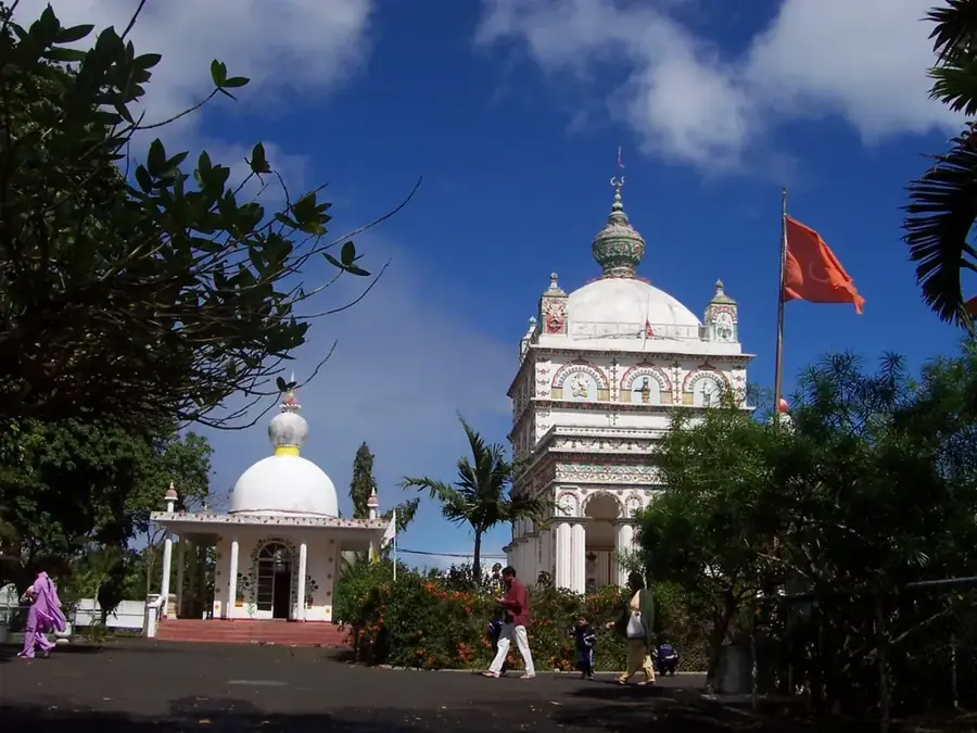
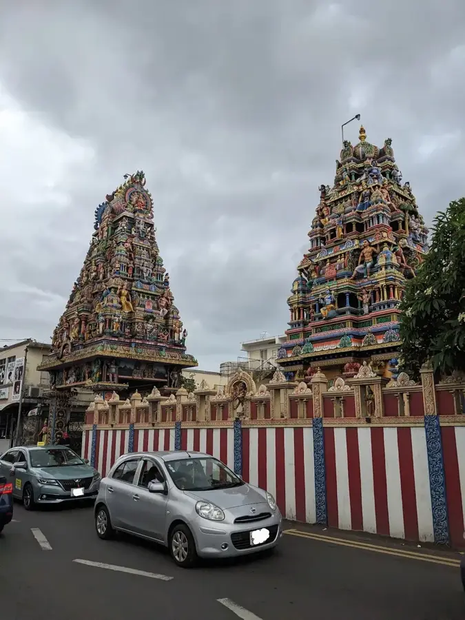
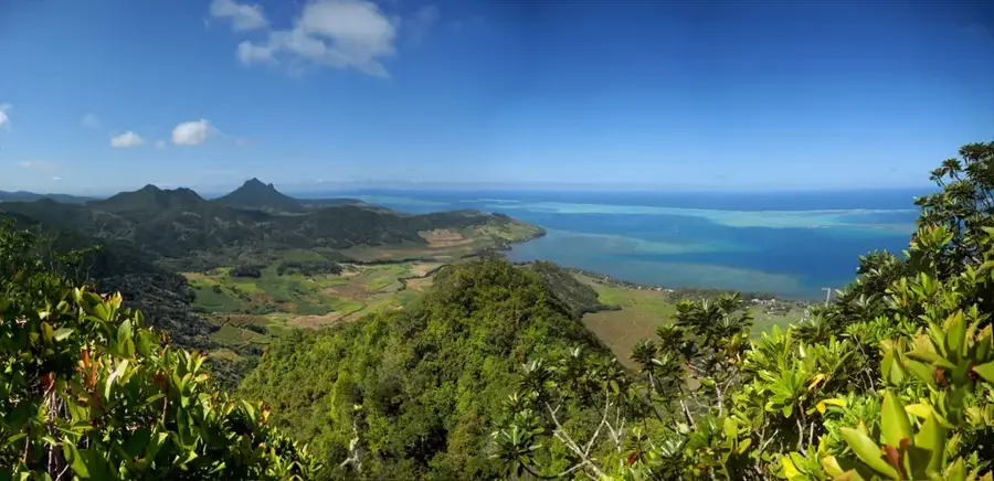
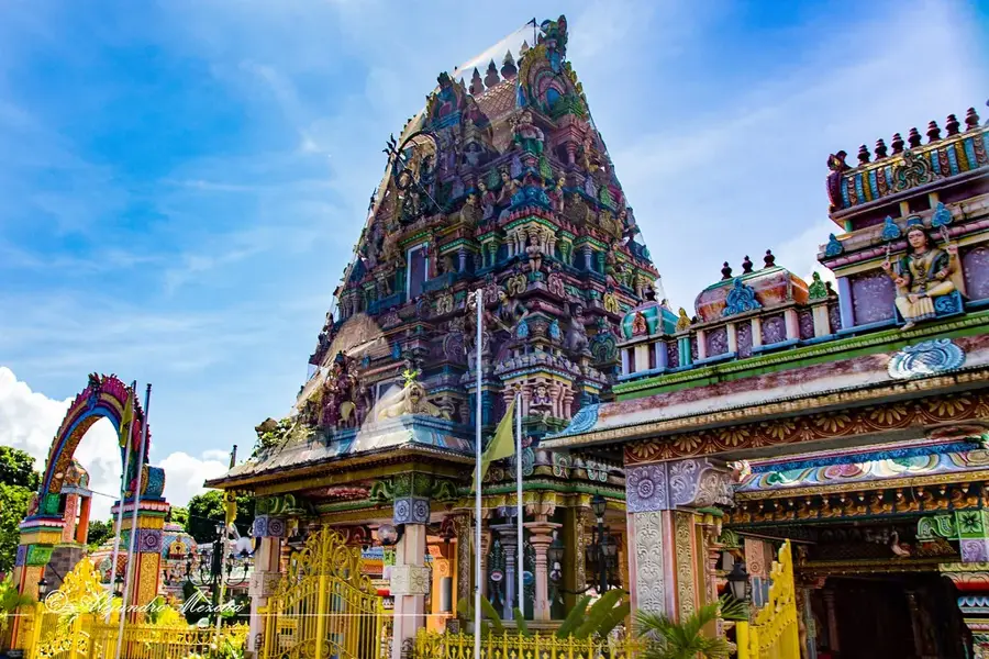
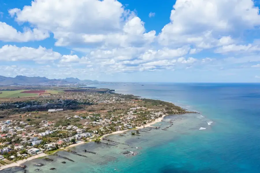
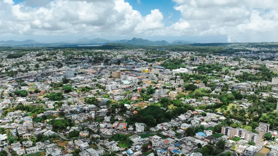
Curepipe, affectionately known as 'La Ville Lumière' (The City of Light), sits on the central plateau of Mauritius at an elevation of about 560 meters, making it the highest major town on the island. Its altitude provides a refreshing, cool climate that is often misty and damp, a stark contrast to the tropical heat of the coast. The town flourished in the late 19th century as people fled the coastal malaria outbreaks for the healthier highland air. The crown jewel of Curepipe is Trou aux Cerfs, a dormant volcanic crater offering panoramic panoramic views of the island's jagged mountain ranges. Economically, the town is a hub for the tea trade and is world-renowned for its exquisite ship model-making industry, where craftsmen meticulously build replicas of famous historical vessels. With its blend of colonial architecture, such as the historic Town Hall, lush botanical gardens, and bustling commercial streets, Curepipe remains a sophisticated cultural and economic heart of mainland Mauritius.
- Location: Mauritius
- Top sights: Domaine Des Aubineaux - Tea Museum · Curepipe Botanic Gardens · The Millenium Tower
- Nearby: Vacoas-Phoenix (4 km)
- Population: ~78.618 (2023)
Best time to visit & climate
The most pleasant time to visit is Jul–Sep.
| Jan | Feb | Mar | Apr | May | Jun | Jul | Aug | Sep | Oct | Nov | Dec | |
|---|---|---|---|---|---|---|---|---|---|---|---|---|
| Avg °C | 27 | 27 | 27 | 26 | 25 | 23 | 22 | 22 | 23 | 24 | 25 | 26 |
| Rain mm | 127 | 113 | 124 | 79 | 47 | 32 | 28 | 26 | 29 | 31 | 34 | 48 |
Geography
Facts
- Highest town on the island (approx. 560 m)
- The Trou aux Cerfs crater is 605 meters high
- The name likely comes from 'Curé' (cured) and 'Pipe'
- The Town Hall (Hôtel de Ville) is a masterpiece of wooden architecture
- The town is a center for the ship model-making industry
- Home to Royal College Curepipe, founded in the 18th century
Explore nearby
Notable places around
Route planner — Car & Motorhome
Where do you start? We build the route here, with stops and country notes along the way.
© OpenStreetMap contributors · OpenRouteService
Sights in the town Curepipe (4)
Frequently asked questions
How much time should I spend in Curepipe?
Is the Trou aux Cerfs crater easily accessible?
When is the best weather in Curepipe?
Are there good shopping options?
Is the town suitable for families?
Curepipe: where is it located?
Curepipe: what is there to see?
Curepipe: when is the best time to visit?
Curepipe: why is it worth visiting?

Nearby cities