Plizio Visual Lab
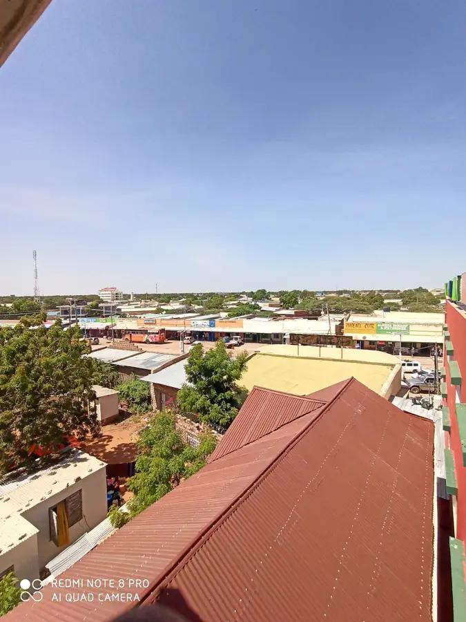
Wajir
ℹ️Practical info — Wajir
▾
🌤 Weather — 5 days
📍 Nearby
Sights nearby
💡 Tips
- Respect Islamic customs; dress conservatively by covering your shoulders and knees.
- Travel early in the morning as afternoon temperatures can become extremely high in this semi-arid region.
- Always drink plenty of bottled water and avoid being outdoors during the hottest hours.
- Do not photograph camels or nomads without explicit permission to avoid cultural misunderstandings.
🍽 Food
Try fresh camel milk, which you can find in the local markets early in the morning.
A spicy Somali rice dish with meat, often served in the city's Somali-run restaurants.
Enjoy heavily sweetened chai with cardamom in small tea shops, good for afternoon conversations.
🛍 Shopping · 🧘 Quiet spots
Experience the bustling activity when nomads trade their camels, goats, and cattle.
Buy fragrant frankincense and myrrh in the small shops around the mosques.
A small but quiet place to learn about the history and traditions of the local pastoral communities.
The historical Italian ruins offer a peaceful moment away from the modern town.
Water temperature…
Wajir is a historically significant town in northeastern Kenya, serving as the administrative center of Wajir County in a predominantly arid region. The town was established in the early 20th century as a key trading post along the caravan routes between Ethiopia and the Kenyan coast. Due to its desert location, Wajir is known for its unique limestone architecture and its numerous deep-set wells that have secured the water supply for generations. The local economy is almost exclusively dominated by nomadic pastoralism, with camels, goats, and sheep being the most important trade commodities. Cultural landmarks include the Wajir Museum, which provides insights into the region's history and the traditions of the Somali people who inhabit the area. During World War II, the town played a strategic role as a base for British forces fighting against Italian troops from Somalia. Today, Wajir is better connected to the rest of the country via its international airport and is working on modernizing its infrastructure under challenging climatic conditions.
- Location: Kenya
- Population: ~90.116 (2022)
Best time to visit & climate
The most pleasant time to visit is Jun–Aug.
| Jan | Feb | Mar | Apr | May | Jun | Jul | Aug | Sep | Oct | Nov | Dec | |
|---|---|---|---|---|---|---|---|---|---|---|---|---|
| Avg °C | 29 | 31 | 31 | 29 | 28 | 27 | 27 | 27 | 29 | 29 | 28 | 28 |
| Rain mm | 14 | 7 | 35 | 124 | 42 | 6 | 4 | 5 | 8 | 72 | 108 | 45 |
Geography
Facts
- Wajir was officially established by British colonial administrators in 1912.
- The famous historical wells of Wajir reach depths of up to 20 meters.
- The Wajir Museum was opened in 2011 to showcase Somali cultural heritage.
- Wajir was a site of military action during World War II in 1940.
- The average annual temperature in the town is approximately 28°C.
- Wajir Airport serves as a major logistical hub for northeastern Kenya.
Explore nearby
Notable places around
Route planner — Car & Motorhome
Where do you start? We build the route here, with stops and country notes along the way.
© OpenStreetMap contributors · OpenRouteService
Sights in the town Wajir (1)
Frequently asked questions
What is the historical significance of Wajir?
How is the climate in Wajir?
How do you get to Wajir?
What is the main source of income in Wajir?
Are there museums in Wajir?
Wajir: where is it located?
Wajir: when is the best time to visit?
Wajir: why is it worth visiting?

Nearby cities