Plizio Visual Lab
Mangystau (Aktau hinterland)

Weather…
Water temperature…
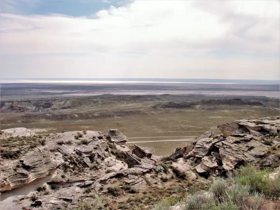
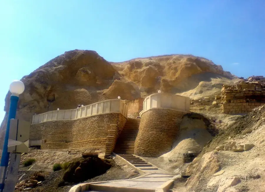
The Mangystau region in western Kazakhstan is a place of almost extraterrestrial beauty. The Aktau hinterland is defined by the Ustyurt Plateau, where millions of years of erosion have sculpted spectacular formations like Bozzhyra. Here, giant limestone needles pierce the sky, while the ground is scattered with fossilized shark teeth, a legacy of the ancient Tethys Ocean. Beyond its natural wonders, the region is famous for its spiritual significance. Hundreds of underground mosques, such as the impressive Shakpak-Ata or Beket-Ata, are carved into the soft rock, drawing pilgrims from across Central Asia. The Valley of Balls (Torysh), with its mysterious spherical boulders, is another highlight for geology enthusiasts. Traveling through this inhospitable terrain strictly requires a 4WD vehicle and ideally an experienced guide, as paved roads are nearly non-existent. The local cuisine is deeply rooted in nomadic traditions, dominated by camel milk (Shubat) and meat dishes. The best times to visit are spring (April-May) and autumn (September-October), as summer temperatures are extreme and winters are piercingly cold. A visit here is an expedition into one of the quietest and most majestic corners of the world.
- Location: Kazakhstan
- Nearby: Zhanaozen (63 km)
📋 Practical info
Geography
Facts
- Part of the Ustyurt Plateau
- Land of 362 saints
- Remnants of the Tethys Ocean
- Valley of Balls (Torysh)
- Bozzhyra formations (Canyons)
- Shakpak-Ata underground mosque
- Lowest point: Karagiye Depression
- Rare desert flora and fauna
Explore nearby
Notable places around
Route planner — Car & Motorhome
Where do you start? We build the route here, with stops and country notes along the way.
© OpenStreetMap contributors · OpenRouteService
Sights nearby
Frequently asked questions
Mangystau (Aktau hinterland): where is it located?
Mangystau (Aktau hinterland): why is it worth visiting?

Nearby cities

More places