Plizio Visual Lab
Hoher Meißner
Weather…
Water temperature…
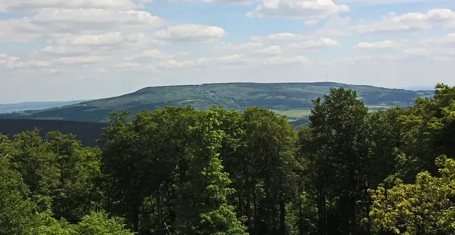
The Hoher Meißner is a prominent mountain massif in the North Hessian Highlands, reaching an elevation of 753.6 meters. It consists of a basalt plateau resting on layers of lignite and sandstone, formed approximately 10 to 15 million years ago by volcanic activity. The mountain is famously associated with the fairy tales of the Brothers Grimm, as Mother Holle is said to reside in the Frau-Holle-Teich pond located there. Historically significant is the centuries-long lignite mining industry, which persisted until 1974 and shaped the landscape with spoil heaps and sinkholes. A unique geological phenomenon is the 'Stinksteinwände' (Stinking Stone Walls), where spontaneous combustion of lignite seams caused underground fires that smoldered for centuries. Today, the entire massif is a major nature reserve hosting alpine relict plants and rare moorlands. Additionally, the mountain serves as a vital transmission site for the Hessian Broadcasting Corporation.
- Location: Lower Saxony, Germany
- Top sights: Kasseler Kuppe · Neuer Stollen · Bransroderstollen
- Nearby: Großalmerode (6 km)
Best time to visit & climate
The most pleasant time to visit is Jun–Aug.
| Jan | Feb | Mar | Apr | May | Jun | Jul | Aug | Sep | Oct | Nov | Dec | |
|---|---|---|---|---|---|---|---|---|---|---|---|---|
| Avg °C | -1 | 0 | 3 | 8 | 12 | 16 | 19 | 18 | 14 | 9 | 4 | 0 |
| Rain mm | 67 | 48 | 52 | 40 | 76 | 65 | 82 | 68 | 58 | 56 | 63 | 68 |
📋 Practical info
Geography
Facts
- Highest point is located at 753.6 meters.
- Lignite mining was conducted from 1560 to 1974.
- Legendary residence of Mother Holle according to folklore.
- The basalt plateau is approximately 10 kilometers long.
- Annual average temperature at the summit is 5.8 degrees.
- First mine fire in the Stinksteinwände was reported in 1545.
Explore nearby
Notable places around
Route planner — Car & Motorhome
Where do you start? We build the route here, with stops and country notes along the way.
© OpenStreetMap contributors · OpenRouteService
Sights in the town Hoher Meißner (10)
Meißner
Nature reserve in Hesse. Protects slopes and parts of the Hoher Meißner plateau, consists of 8 sub-areas.
Aussichtspunkt Heiligenberg
Viewpoint on the Heiligenberg. View over the Hoher Meißner and the surrounding area.
Heiligenberg
Hill in Hesse, Germany. Wooded summit in the Hoher Meißner area.
Frau-Holle-Teich
Lake in Hesse, Germany. Small lake on the Hoher Meißner plateau, associated with the legend.
Kalbe
Viewpoint at the Hoher Meißner. Wide view over the landscape.
Bühlchen bei Weißenbach
Nature reserve in Hesse. Hilltop with calcareous grassland and junipers, about 1 km south of Weißenbach near Großalmerode.
Bergwiese
Viewpoint at the Hoher Meißner. Open meadow with a view into the valley.
Sights nearby
Frequently asked questions
Why is the Hoher Meißner famous?
What is the Frau-Holle-Teich?
Are there mining-related features there?
What are the 'Stinksteinwände'?
Are there opportunities for winter sports?
Hoher Meißner: where is it located?
Hoher Meißner: what is there to see?
Hoher Meißner: when is the best time to visit?
Hoher Meißner: why is it worth visiting?

Nearby cities