Aa-Aue
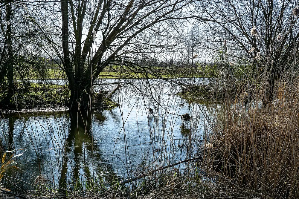
The Aa-Aue is a picturesque nature reserve located in the city of Münster, North Rhine-Westphalia. Spanning the scenic banks and floodplains of the Münstersche Aa river, this protected area serves as a vital green lung for the region. It is highly valued for its tranquil atmosphere and preserved natural landscapes, offering a stark contrast to the urban environment.
Ecologically, the Aa-Aue plays a crucial role in maintaining regional biodiversity. The reserve encompasses lush meadows, wetlands, and riparian forests that provide an essential habitat for numerous bird species, amphibians, and aquatic life. The natural course of the river allows nature enthusiasts to observe local wildlife in a pristine setting, making it a key site for ecological conservation.
For visitors, the reserve is an ideal destination for outdoor recreation. A well-maintained network of trails invites people to enjoy walking, jogging, and cycling along the riverbanks. It is a peaceful retreat where one can immerse themselves in nature. Whether you are looking for a leisurely afternoon stroll or a dedicated bird-watching excursion, the Aa-Aue offers a refreshing and restorative experience.
Weather…
Best time to visit & climate
The most pleasant time to visit is Jun–Aug.
| Jan | Feb | Mar | Apr | May | Jun | Jul | Aug | Sep | Oct | Nov | Dec | |
|---|---|---|---|---|---|---|---|---|---|---|---|---|
| Avg °C | 1 | 2 | 5 | 9 | 13 | 17 | 19 | 18 | 15 | 10 | 6 | 3 |
| Rain mm | 76 | 58 | 54 | 41 | 61 | 63 | 75 | 77 | 59 | 63 | 69 | 75 |
Practical info
Tips
- Bring a camera or binoculars for bird watching.
- Combine your walk with a bike tour around Münster.
- Wear comfortable walking shoes.
FAQ
What is the Aa-Aue?
What can you do there?
When is the best time to visit?
How far is it from the city center?
Route planner — Car & Motorhome
Where do you start? We build the route here, with stops and country notes along the way.
© OpenStreetMap contributors · OpenRouteService
Attractions nearby
- Alstedder Mark 35 km
- Soestwarte 43 km
- Alter Rathausturm 46 km
- Am Quellmuhlenbach 51 km
- Ahse nördlich Lohne 59 km
- Abgrabung Retlager Bach 84 km