Plizio Visual Lab
Mount Pangala

Weather…
Water temperature…
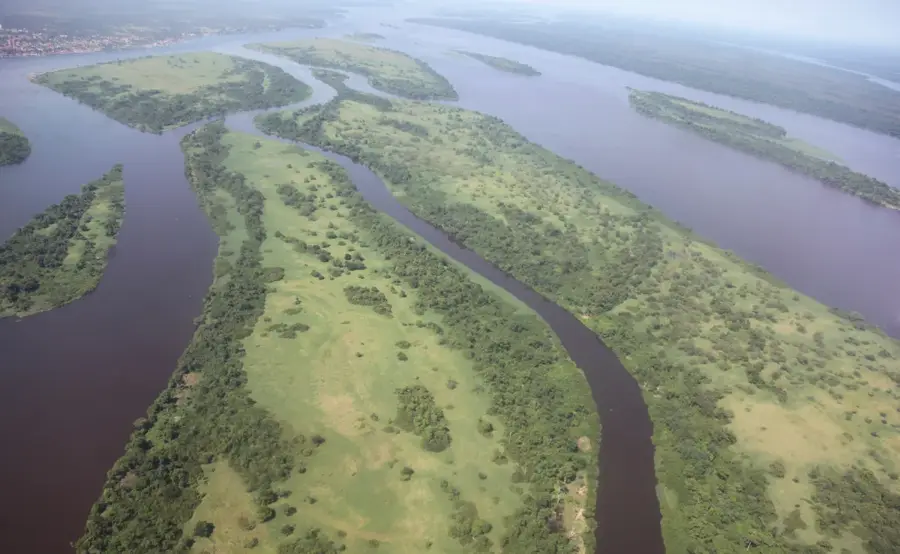
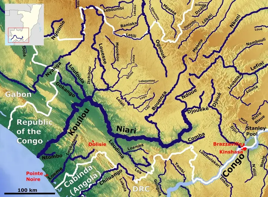
Mount Pangala is a prominent isolated peak located in the Pool Department of the southwestern Republic of the Congo, near the town of Mindouli. Geographically, the mountain serves as a significant landmark within the rugged transition zone between the Niari Basin and the Batéké Plateau systems. From its summit, visitors are treated to expansive panoramic views overlooking the vast grass savannas and the deeply incised river valleys that define the regional landscape. Geologically, the peak is composed of durable sandstone formations that have withstood millennia of tropical erosion, rising sharply above the surrounding terrain. The vegetation on Mount Pangala is a mix of dry savanna species on the exposed slopes and lush gallery forests tucked into the sheltered ravines. For local communities, the mountain holds cultural value as a traditional point of orientation and a growing destination for eco-trekking. The climate at this elevation is notably fresher, especially during the dry season from June to August, when the golden grasses create a striking contrast with the blue horizon.
- Location: Congo - Brazzaville
- Nearby: Mindouli (29 km)
Best time to visit & climate
The most pleasant time to visit is Jun–Aug.
| Jan | Feb | Mar | Apr | May | Jun | Jul | Aug | Sep | Oct | Nov | Dec | |
|---|---|---|---|---|---|---|---|---|---|---|---|---|
| Avg °C | 25 | 25 | 25 | 25 | 25 | 24 | 24 | 25 | 26 | 26 | 25 | 25 |
| Rain mm | 170 | 162 | 205 | 192 | 137 | 11 | 2 | 6 | 39 | 168 | 280 | 236 |
📋 Practical info
Geography
Facts
- The mountain is located in the Pool region, near the town of Mindouli.
- It is primarily composed of sandstone dating back to the Cretaceous period.
- The summit offers an ideal location for regional telecommunication towers.
- The local climate is significantly drier than that of the central Congo Basin.
- Numerous small streams originating on its slopes feed into the Niari River system.
- Local legends associate the mountain peak with traditional protective spirits.
Explore nearby
Notable places around
Route planner — Car & Motorhome
Where do you start? We build the route here, with stops and country notes along the way.
© OpenStreetMap contributors · OpenRouteService
Sights nearby
Frequently asked questions
Where is Mont Pangala located?
How high is Mont Pangala?
What is the characteristic feature of the relief?
Are there hiking trails to the summit?
What can you see from the summit?
Mount Pangala: where is it located?
Mount Pangala: when is the best time to visit?
Mount Pangala: why is it worth visiting?

Nearby cities


History & landmarks

Nature
More places