Plizio Visual Lab
Cova Figueira
ℹ️Practical info — Cova Figueira
▾
🌤 Weather — 5 days
📍 Nearby
Sights nearby
💡 Tips
- The town is a great base for exploring Fogo National Park, but hire a local guide for the volcanic trails.
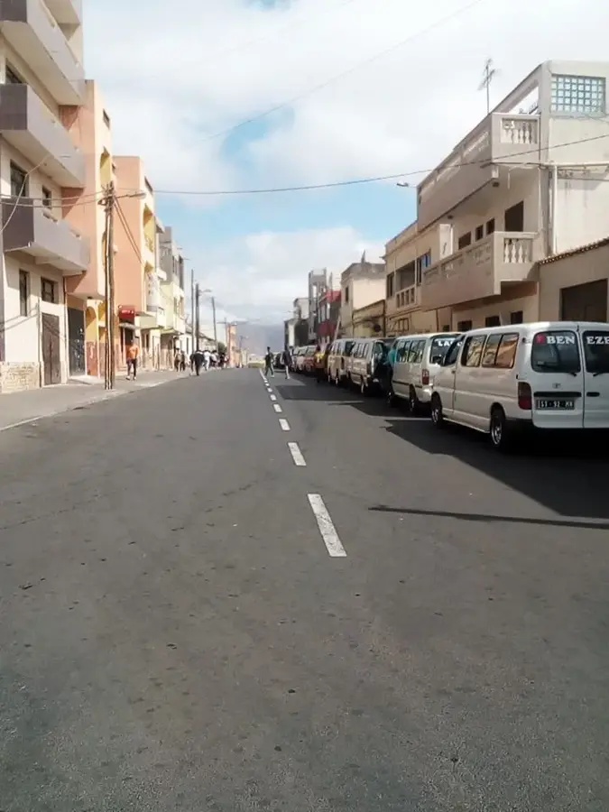
- Transport to São Filipe relies mostly on 'alugueres' (shared minivans) which leave when full.
- The landscape is very dry, always carry plenty of water and sun protection.
- English is rarely spoken, learn a few phrases in Portuguese or Cape Verdean Creole.
🍽 Food
The national stew; ask at small local eateries for this hearty dish made with corn and beans.
Renowned locally, try it at a traditional cafe in the town center.
Often served with papaya jam, look for it in local grocery shops.
🛍 Shopping · 🧘 Quiet spots
Known as Manecom, purchase locally produced wine directly from small shops or markets.
Buy fresh fruits and beans at the street markets.
Take a quiet walk on the paths just outside the town towards the volcano for stark, beautiful views.
The main square is a calm place to sit in the shade during the afternoon heat.
Water temperature…
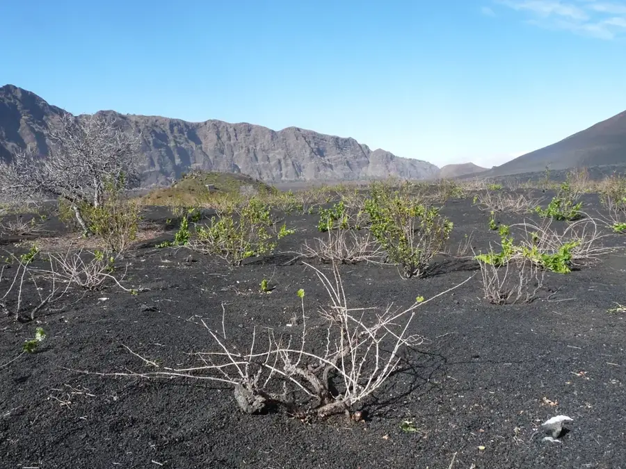
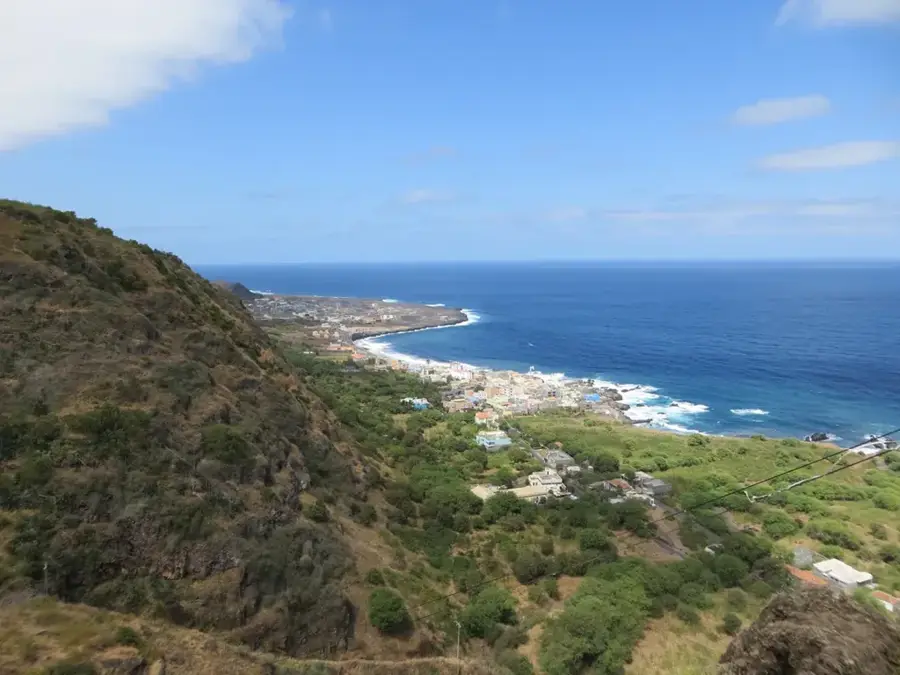
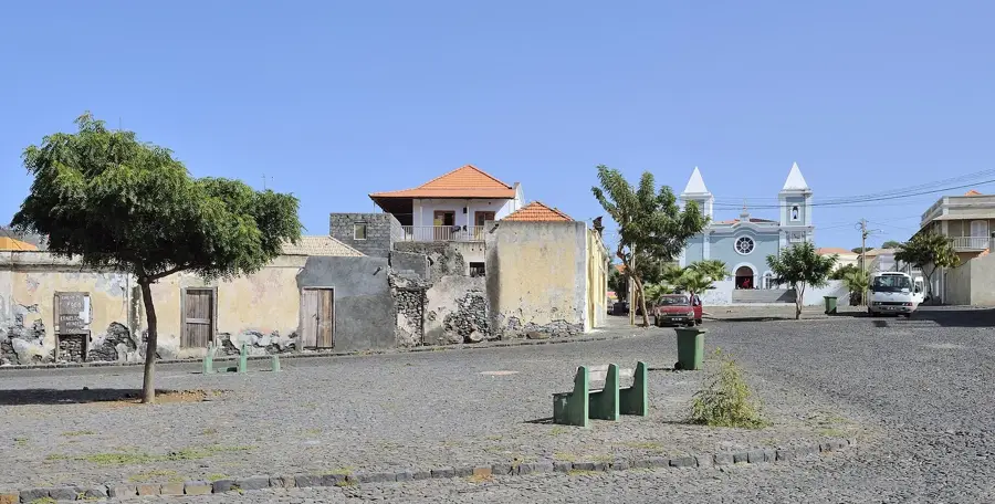
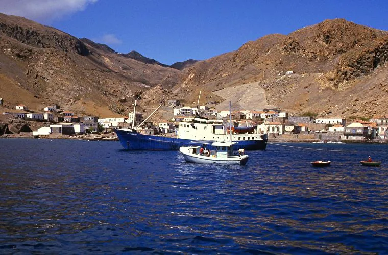
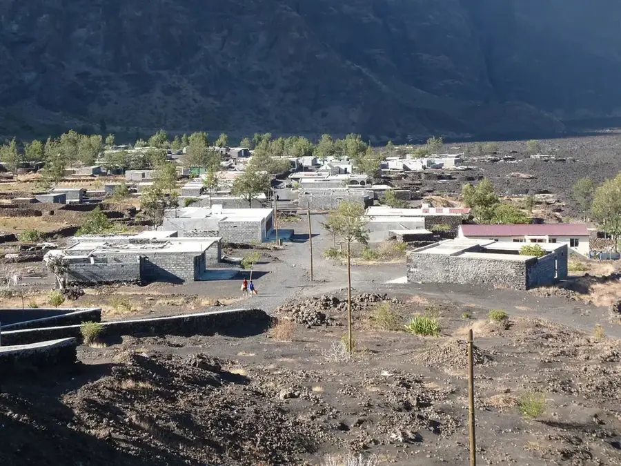
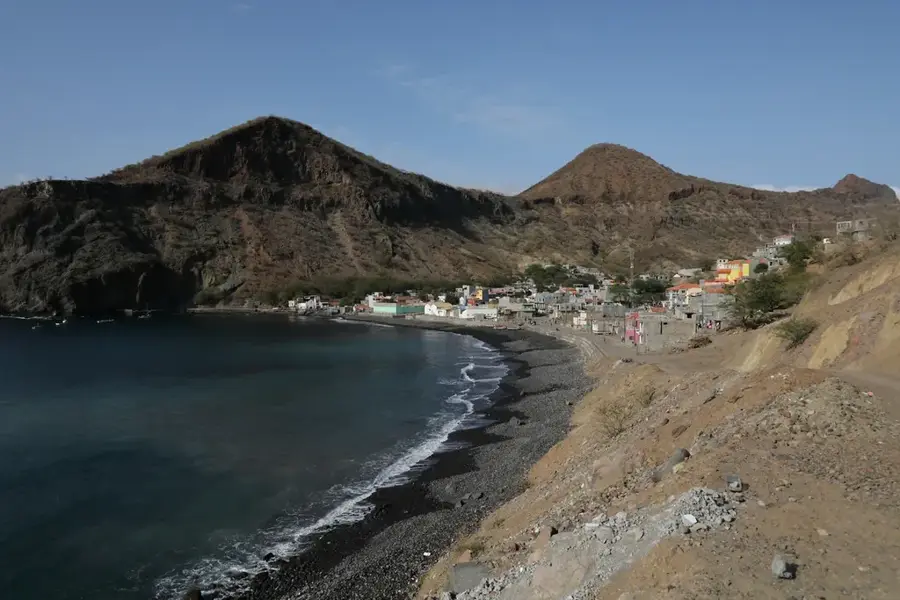
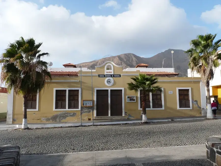
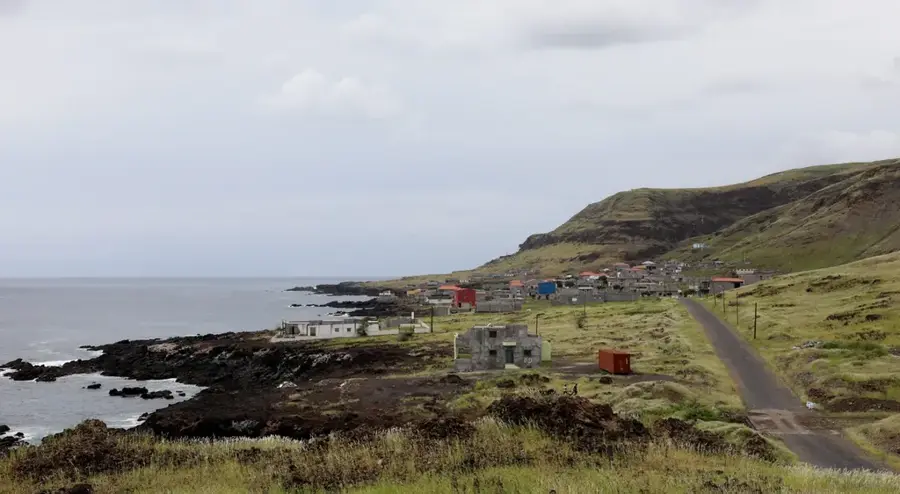
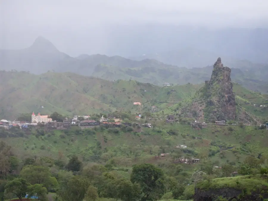
Cova Figueira is the administrative center of the Santa Catarina do Fogo municipality, located on the southeastern side of Fogo Island. The town is dramatically situated on the lower slopes of the volcano, with a landscape often scarred by historic lava flows, giving the surroundings a surreal, lunar appearance. Despite the rugged environment, the region is well-known for grape cultivation and wine production, which flourishes in the nutrient-dense volcanic ash soil. Cova Figueira serves as a vital gateway for those traveling to the Fogo National Park and Chã das Caldeiras, the inhabited caldera of the volcano. The town's architecture features many newer constructions, reflecting its steady growth in recent decades. The local population relies primarily on agriculture and livestock farming, though water scarcity remains a persistent challenge due to the arid climate. The town has sweeping views over the rugged southeastern coastline toward the distant Atlantic horizon.
- Location: Cape Verde
- Top sights: Estância Roque · Santa Catarina do Fogo, Cape Verde · Figueira Pavão
- Nearby: Chã das Caldeiras (9 km)
- Population: ~720 (2026)
Best time to visit & climate
The most pleasant time to visit is Mar–May.
| Jan | Feb | Mar | Apr | May | Jun | Jul | Aug | Sep | Oct | Nov | Dec | |
|---|---|---|---|---|---|---|---|---|---|---|---|---|
| Avg °C | 23 | 22 | 22 | 22 | 23 | 24 | 25 | 26 | 27 | 27 | 26 | 24 |
| Rain mm | 23 | 29 | 11 | 8 | 6 | 5 | 13 | 56 | 83 | 47 | 47 | 41 |
Geography
Facts
- Cova Figueira became the seat of the Santa Catarina municipality in 2005.
- The town is situated at an elevation of approximately 450 meters.
- The surrounding area produces grapes used for the famous Manecom wine.
- The town is located on the main circular highway of Fogo Island.
- Cova Figueira was affected by ash fall during the 2014 volcanic eruption.
- The festival of Santa Catarina on November 25th is the local annual highlight.
Explore nearby
Notable places around
Route planner — Car & Motorhome
Where do you start? We build the route here, with stops and country notes along the way.
© OpenStreetMap contributors · OpenRouteService
Sights in the town Cova Figueira (3)
Frequently asked questions
What can you see in Cova Figueira?
Is it an important transit point?
How do people live there?
Are there shops there?
Is it worth a stop?
Cova Figueira: where is it located?
Cova Figueira: what is there to see?
Cova Figueira: when is the best time to visit?
Cova Figueira: why is it worth visiting?

Nearby cities

More places