Plizio Visual Lab
Humber Arm South
ℹ️Practical info — Humber Arm South
▾
🌤 Weather — 5 days
📍 Nearby
Sights nearby
💡 Tips
- Drive the Captain Cook Trail for spectacular views of the fjord-like landscapes of the Bay of Islands.
- Keep an eye out for whales and bald eagles which can often be spotted along the coastline.
- Weather changes quickly in the fjords, so always pack waterproof gear just in case.
- Plan extra time to stop at the scenic lookouts along the coastal road for wide-open photos.
🍽 Food
A Newfoundland classic, best enjoyed at a local pub or cozy family diner.
Try this fried bread dough traditionally served with molasses for a hearty breakfast.
Look for local products made from these unique cloudberries at small local shops.
🛍 Shopping · 🧘 Quiet spots
Keep an eye out for handmade wool mittens and cozy socks crafted by local artisans.
Pick up a jar of partridgeberry or bakeapple jam as a truly unique local souvenir.
A serene spot to simply sit, watch the waves, and enjoy the dramatic landscape.
Hike the quiet network of trails to find incredible panoramic views of the fjord.
Water temperature…
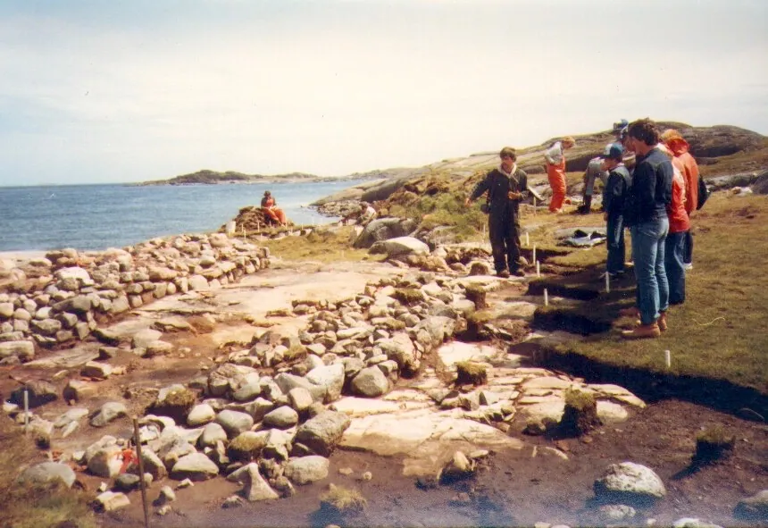
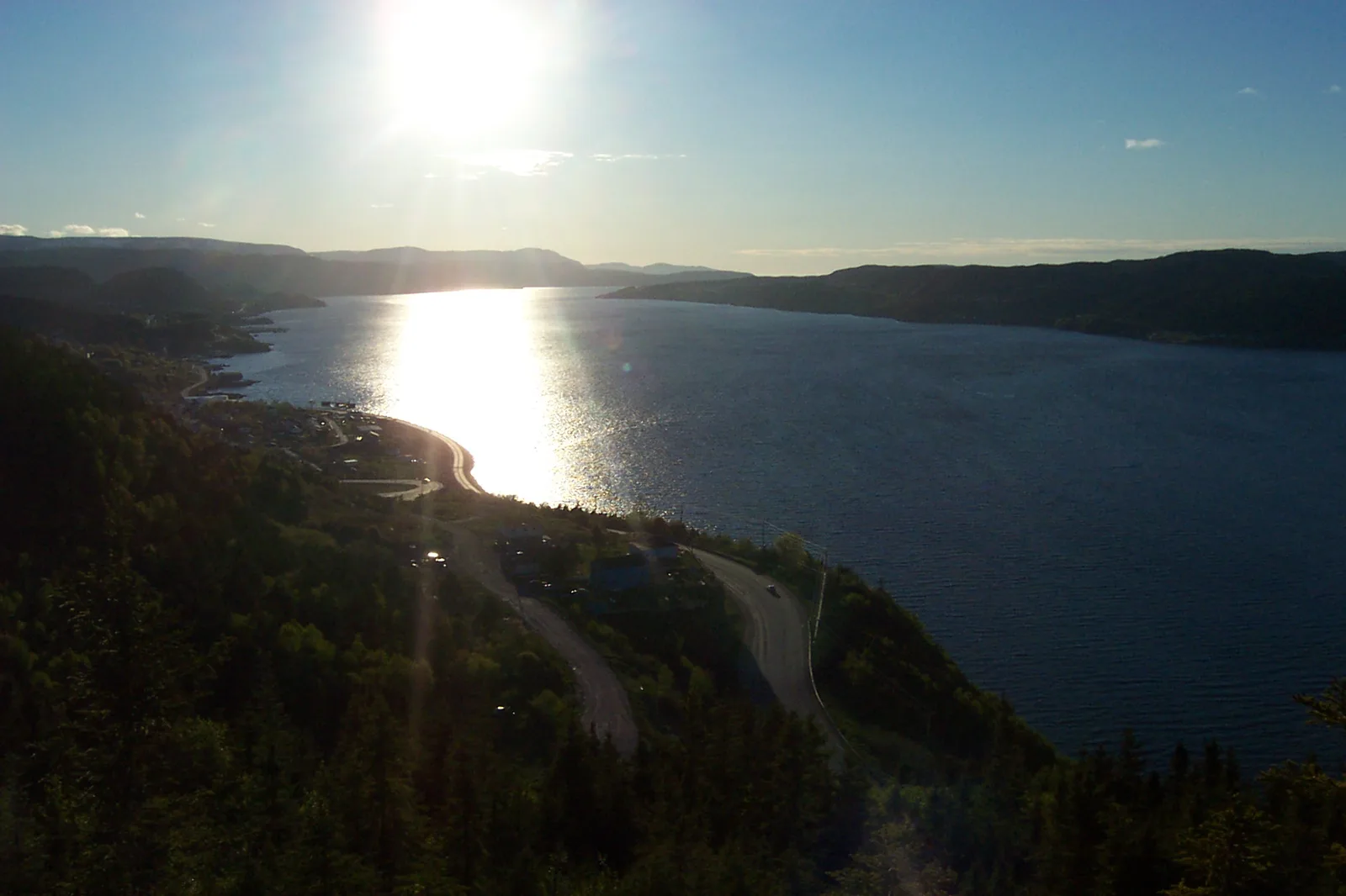
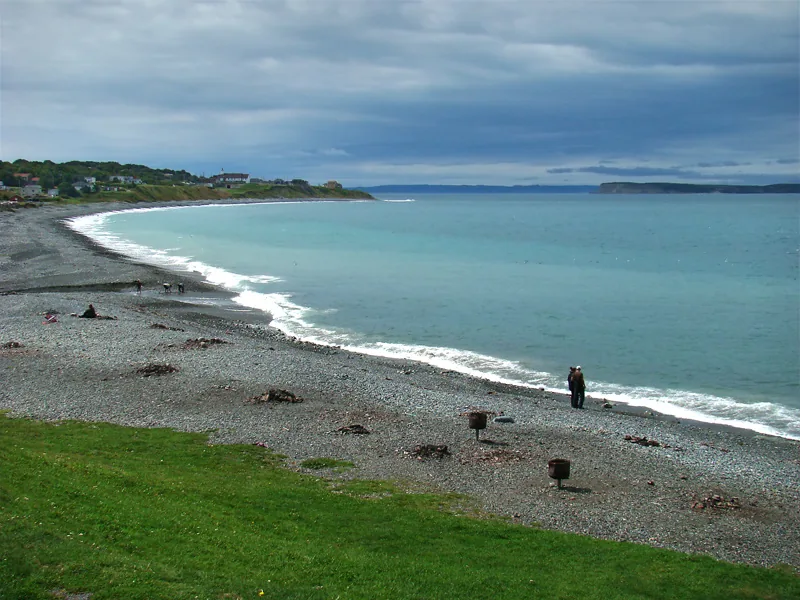
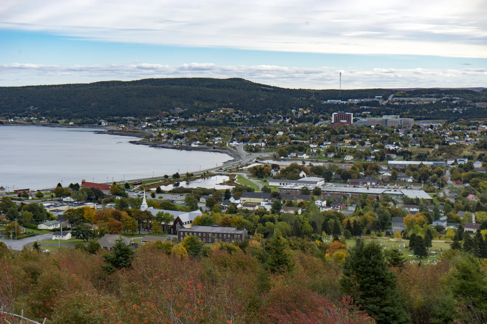
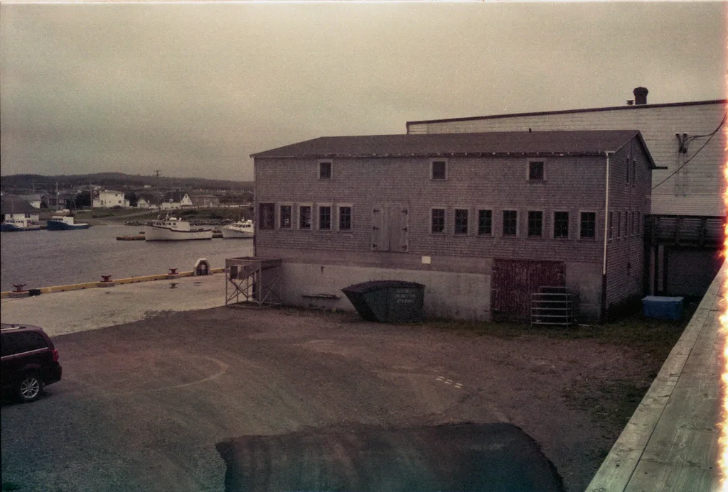
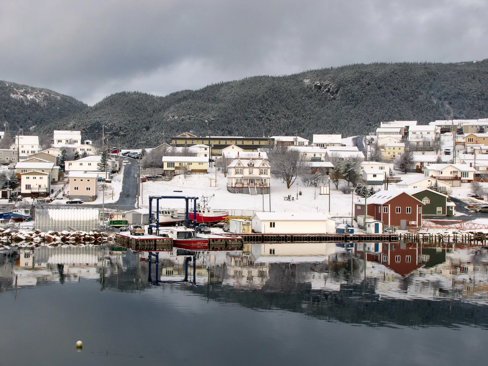
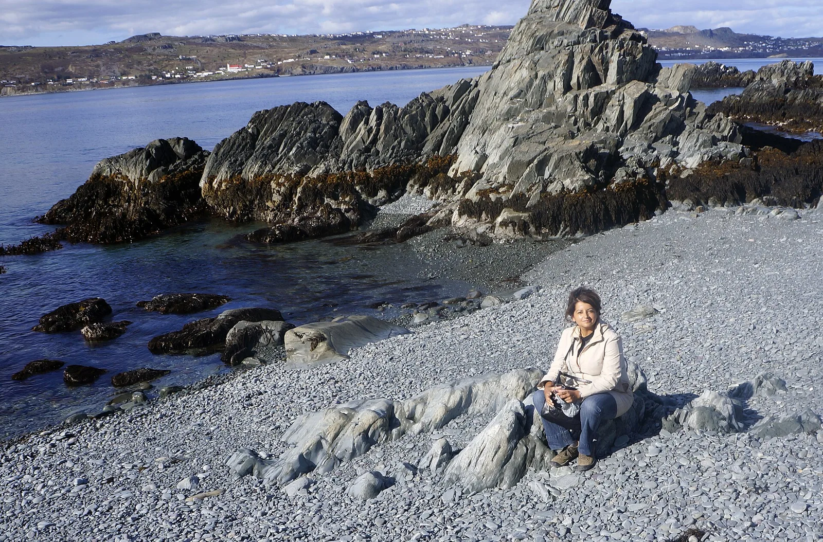
Humber Arm South consists of several appealing communities set along the southern shore of the Bay of Islands in Newfoundland. The area is renowned for its dramatic topography, where steep mountains rise directly from the deep blue waters, creating a fjord-like environment. Visitors can seek tranquility at Lower Beach and John's Beach, both providing serene settings for shoreline exploration and photography. The local way of life remains closely tied to the sea, and the fishing heritage is evident in the small harbors and traditional architecture. Gastronomy in the area focuses on fresh Atlantic seafood, offering visitors a taste of authentic Newfoundland flavors. Hiking and boating are popular activities for those wishing to immerse themselves in the rugged natural beauty. Access is provided via the scenic Route 450, a drive that gives constant views of the bay and surrounding peaks. Whether visiting for the outdoor adventure or the peaceful coastal atmosphere, Humber Arm South has a genuine maritime experience in one of Canada's most beautiful eastern regions.
- Location: Canada
- Top sights: Lower Beach · John's Beach
- Nearby: Cox's Cove (11 km)
- Population: ~1.537 (2026)
Best time to visit & climate
The most pleasant time to visit is Jun–Aug.
| Jan | Feb | Mar | Apr | May | Jun | Jul | Aug | Sep | Oct | Nov | Dec | |
|---|---|---|---|---|---|---|---|---|---|---|---|---|
| Avg °C | -7 | -7 | -5 | 0 | 6 | 11 | 16 | 16 | 12 | 7 | 1 | -3 |
| Rain mm | 123 | 111 | 88 | 83 | 91 | 91 | 104 | 113 | 125 | 118 | 125 | 127 |
Geography
Facts
- Located on Bay of Islands
- Newfoundland & Labrador province
- Fjord-like scenery
- Home to Lower Beach
- Home to John's Beach
- Near Corner Brook
- Strong fishing heritage
- Accessible via Route 450
Explore nearby
Notable places around
Route planner — Car & Motorhome
Where do you start? We build the route here, with stops and country notes along the way.
© OpenStreetMap contributors · OpenRouteService
Frequently asked questions
Best viewpoints?
What activities are available?
How is the weather?
How much time to plan?
Are there accommodations?
Humber Arm South: where is it located?
Humber Arm South: what is there to see?
Humber Arm South: when is the best time to visit?
Humber Arm South: why is it worth visiting?

Nearby cities


History & landmarks


More places