Plizio Visual Lab
El Cerro del Aripo

Weather…
Water temperature…
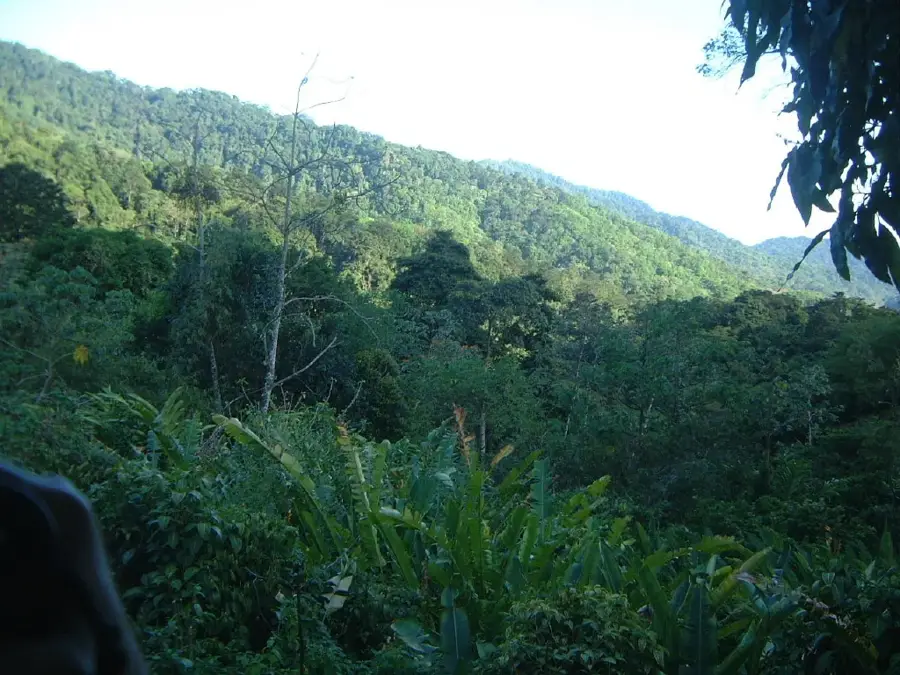
El Cerro del Aripo is the highest point in the Republic of Trinidad and Tobago, reaching an elevation of 940 meters above sea level. Located in the heart of the Northern Range, this limestone massif is covered by a dense elfin woodland and montane rainforest that supports a high level of endemism. The peak is frequently shrouded in mist, creating a unique microclimate that allows for the growth of rare orchids, ferns, and mosses not found at lower altitudes. Historically, the area was recognized for its biological importance during the colonial era and remains a critical part of the country's watershed management. Hikers often traverse the rugged and slippery trails from the Aripo Valley to reach the summit, which features a serene experience of the island's most pristine wilderness despite the lack of a panoramic view due to the thick forest canopy. Conservation efforts focus on protecting this fragile ecosystem, which is home to the critically endangered Trinidad Piping-guan (Pawi).
- Location: Trinidad and Tobago
- Nearby: Valencia (7 km)
Best time to visit & climate
The most pleasant time to visit is Feb–Apr.
| Jan | Feb | Mar | Apr | May | Jun | Jul | Aug | Sep | Oct | Nov | Dec | |
|---|---|---|---|---|---|---|---|---|---|---|---|---|
| Avg °C | 26 | 26 | 27 | 28 | 28 | 27 | 27 | 27 | 27 | 27 | 27 | 26 |
| Rain mm | 100 | 61 | 52 | 56 | 117 | 222 | 202 | 202 | 141 | 176 | 213 | 178 |
📋 Practical info
Geography
Facts
- El Cerro del Aripo stands at a height of 940 meters (3,084 feet).
- It is situated within the Aripo-Northern Range Wildlife Reserve.
- The mountain is the primary source for several major river systems in Trinidad.
- The summit area is dominated by elfin woodland, where trees are stunted.
- The ascent typically takes 2.5 to 4 hours depending on trail conditions.
- It is a key habitat for the Golden Tree Frog, found only on Trinidad's high peaks.
Explore nearby
Notable places around
Route planner — Car & Motorhome
Where do you start? We build the route here, with stops and country notes along the way.
© OpenStreetMap contributors · OpenRouteService
Sights in the town El Cerro del Aripo (1)
Sights nearby
Frequently asked questions
How high is El Cerro del Aripo?
Do you need a guide for the ascent?
How long does the ascent take?
Is the trail marked?
Is there an observation deck at the top?
El Cerro del Aripo: where is it located?
El Cerro del Aripo: when is the best time to visit?
El Cerro del Aripo: why is it worth visiting?
More places