Plizio Visual Lab
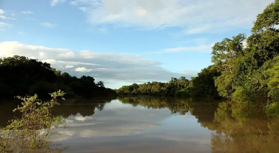
Kainji Reservoir Shore

Weather…
Water temperature…
The shore of the Kainji Reservoir in western Nigeria is a significant man-made landscape of immense ecological and economic importance. Created in 1968 by damming the Niger River primarily for hydroelectric power, the lake remains one of the largest artificial bodies of water in the country. Its shoreline extends for hundreds of kilometers, featuring diverse habitats ranging from shallow wetlands to wooded hillsides. The reservoir not only serves as Nigeria's primary source of renewable energy but also as a hub for commercial inland fishing and large-scale irrigation projects. Geographically, the lake acts as a climatic buffer between the arid North and the more humid central regions. Historically, its creation led to the displacement of over 44,000 people, including the residents of the ancient city of Bussa, which now lies beneath its waters. Today, the reservoir shores are vital for migratory bird species and serve as a focal point for studying the environmental impacts of large-scale tropical dams.
Best time to visit & climate
The most pleasant time to visit is Jan, Nov, Dec.
| Jan | Feb | Mar | Apr | May | Jun | Jul | Aug | Sep | Oct | Nov | Dec | |
|---|---|---|---|---|---|---|---|---|---|---|---|---|
| Avg °C | 24 | 28 | 31 | 31 | 30 | 28 | 27 | 26 | 27 | 27 | 26 | 24 |
| Rain mm | 1 | 2 | 11 | 43 | 120 | 161 | 231 | 307 | 218 | 78 | 3 | 0 |
📋 Practical info
Geography
Facts
- The Kainji Dam was officially completed and commissioned in 1968.
- The reservoir spans a maximum length of approximately 135 kilometers.
- The dam's hydroelectric power plant has a capacity of 760 megawatts.
- Over 44,000 people were resettled during the reservoir's construction.
- The lake covers a surface area of about 1,270 square kilometers at full capacity.
- The reservoir produces more than 10,000 tons of fish annually for the region.
Explore nearby
Notable places around
Route planner — Car & Motorhome
Where do you start? We build the route here, with stops and country notes along the way.
© OpenStreetMap contributors · OpenRouteService
Sights in the town Kainji Reservoir Shore (1)
Sights nearby
Frequently asked questions
Is Kainji reservoir touristic?
Can one visit the dam area?
Is a permit needed?
Is there a restaurant there?
When is the best time for fishing?
Kainji Reservoir Shore: where is it located?
Kainji Reservoir Shore: when is the best time to visit?
Kainji Reservoir Shore: why is it worth visiting?