Plizio Visual Lab
Ruggell Viewpoint 29
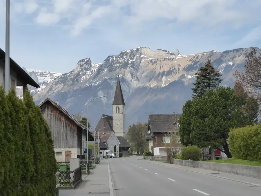
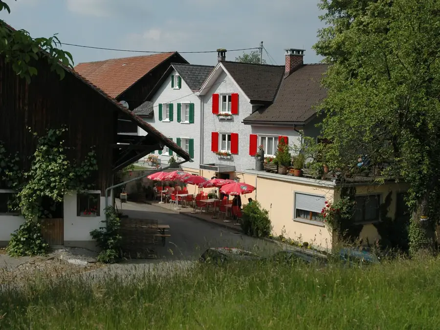
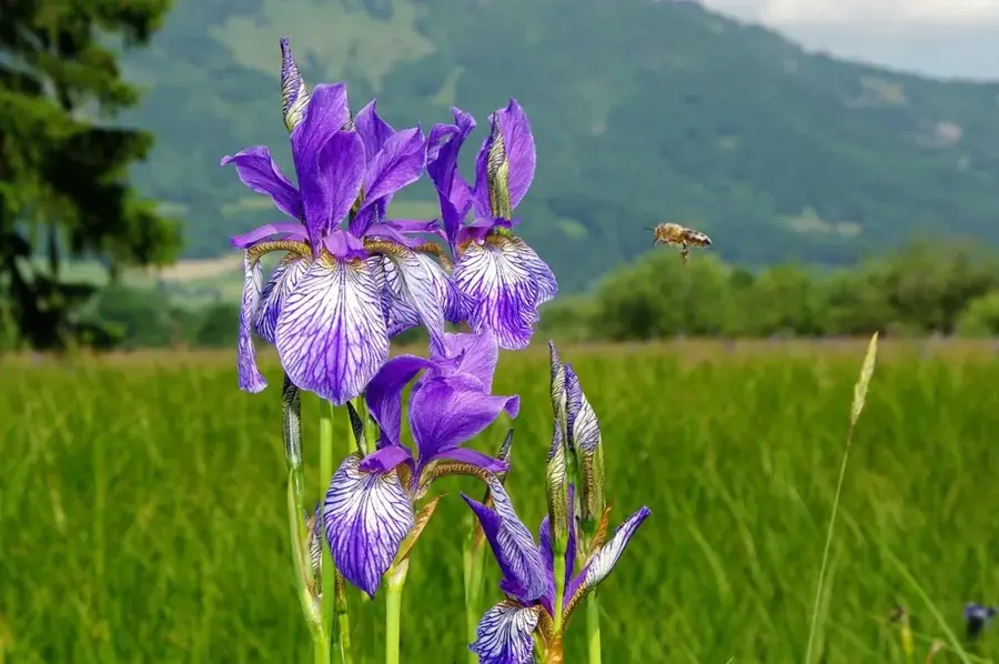
Viewpoint 29 in Ruggell features a fascinating view of Liechtenstein's flattest plain and the adjacent triple-border area. Ruggell is the northernmost municipality in the country and is famous for the Ruggeller Riet, a nature reserve of international significance. This peatland landscape is home to unique flora, including the Siberian iris, which transforms the meadows into a blue sea of flowers in spring. Geographically, Ruggell lies at the foot of the Eschnerberg and directly on the Rhine, which forms the border with Switzerland here. The municipality's history was long defined by agriculture and peat cutting before it evolved into a modern residential community. The viewpoint allows visitors to overlook the vast, open spaces of the Riet, which provide a sharp contrast to the alpine regions further south. The area is also a paradise for cyclists and hikers who appreciate the flat paths along the Rhine embankment and the inland canal. Nature conservation and gentle recreation are combined here in an exemplary manner.
- Location: Liechtenstein
- Top sights: St. Fridolin · Ruine Alt-Schellenberg · Biedermannhaus
- Nearby: Bochs (4 km)
Best time to visit & climate
The most pleasant time to visit is Jul–Sep.
| Jan | Feb | Mar | Apr | May | Jun | Jul | Aug | Sep | Oct | Nov | Dec | |
|---|---|---|---|---|---|---|---|---|---|---|---|---|
| Avg °C | -6 | -5 | -1 | 4 | 8 | 13 | 14 | 14 | 10 | 6 | 0 | -4 |
| Rain mm | 92 | 70 | 91 | 93 | 147 | 173 | 169 | 185 | 121 | 103 | 91 | 93 |
📋 Practical info
Geography
Facts
- Ruggell is located at an altitude of 433 meters, making it the country's lowest-lying municipality.
- The Ruggeller Riet nature reserve covers an area of approximately 90 hectares.
- In 1927, Ruggell was struck by a severe flood of the Rhine.
- The Siberian iris usually blooms in the Ruggeller Riet from late May to early June.
- Ruggell is an important site for high-tech companies in the field of vacuum technology.
- The northernmost point of Liechtenstein is located within the municipality of Ruggell.
Explore nearby
Notable places around
Route planner — Car & Motorhome
Where do you start? We build the route here, with stops and country notes along the way.
© OpenStreetMap contributors · OpenRouteService
Sights in the town Ruggell Viewpoint 29 (10)
Naturschutzgebiet Schneckenäule
Protected area with wet meadows and ponds in Ruggell.
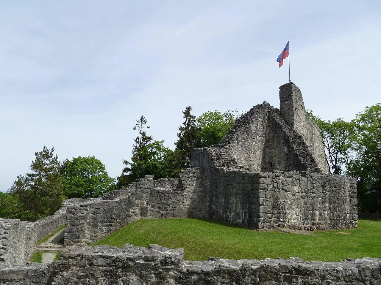
Ruine Neu-Schellenberg🏰 castle
Castle ruin in Liechtenstein, remains of a medieval hill castle.
Kapelle zu den Heiligen Martin und Magnus
Building in Feldkirch, Austria, chapel dedicated to Saints Martin and Magnus.
Eschnerberg
Mountain ridge in Liechtenstein and Vorarlberg, viewpoint and hiking area.
Naturschutzgebiet Au
Nature reserve with floodplain landscape and rich wildlife in Ruggell.
Kapelle Mariahilf
Building in Feldkirch, Austria, chapel dedicated to Mary Help of Christians.
Sights nearby
Frequently asked questions
Is the viewpoint accessible by car?
Is there a telescope on site?
Are the paths lit at night?
Can you see wildlife there?
How difficult is the path?
Ruggell Viewpoint 29: where is it located?
Ruggell Viewpoint 29: what is there to see?
Ruggell Viewpoint 29: when is the best time to visit?
Ruggell Viewpoint 29: why is it worth visiting?

Nature
More places