Plizio Visual Lab
Kwango Plateau
Weather…
Water temperature…
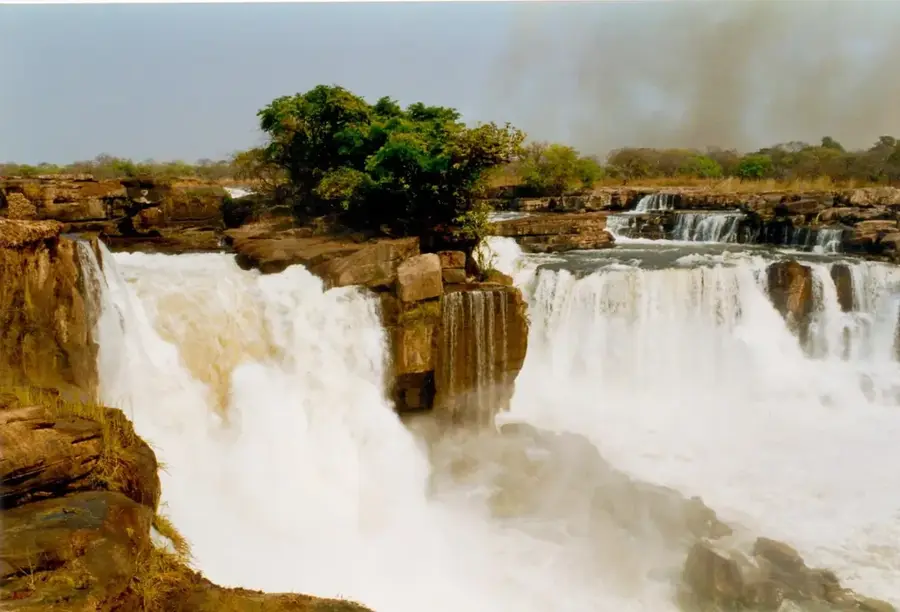
The Kwango Plateau is a significant geographical formation in the southwestern part of the Democratic Republic of the Congo, extending into Angola. Geologically, the plateau is part of the vast Congo Basin and is primarily composed of Mesozoic and Cenozoic sandstone layers deposited over millions of years. It is bordered to the west by the powerful Kwango River, which serves as an important waterway and lifeline for the region. The topography is characterized by gently rolling plains, dissected by numerous small rivers and valleys, reaching an altitude of approximately 500 to 1000 meters above sea level. The climate is tropical savanna, marked by a distinct wet and dry season, which dominates the vegetation, consisting mainly of savanna grassland and gallery forests along the watercourses. Historically, the area is home to various ethnic groups, particularly the Yaka and Suku, whose kingdoms shaped the region for centuries. The plateau's economy relies mainly on agriculture, with cassava, maize, and peanuts being the primary crops for local consumption. Alluvial diamond mining is also practiced in some areas, often under artisanal conditions.
Best time to visit & climate
The most pleasant time to visit is Jun–Aug.
| Jan | Feb | Mar | Apr | May | Jun | Jul | Aug | Sep | Oct | Nov | Dec | |
|---|---|---|---|---|---|---|---|---|---|---|---|---|
| Avg °C | 23 | 24 | 24 | 23 | 24 | 23 | 24 | 25 | 25 | 24 | 23 | 23 |
| Rain mm | 168 | 150 | 201 | 164 | 65 | 14 | 7 | 39 | 98 | 184 | 212 | 195 |
📋 Practical info
Geography
Facts
- The plateau covers an area of several tens of thousands of square kilometers.
- The geological layers consist mainly of sandstone from the Karoo Supergroup.
- The Kwango River is a left tributary of the Kasai River.
- The average annual rainfall ranges between 1,200 and 1,600 mm.
- The Yaka Kingdom was founded in the 16th century in this region.
- The altitude of the plateau varies between 500 and 1000 meters.
Route planner — Car & Motorhome
Where do you start? We build the route here, with stops and country notes along the way.
© OpenStreetMap contributors · OpenRouteService
Sights nearby
Frequently asked questions
Where is the Kwango Plateau located?
What characterizes the region?
Are there waterfalls there?
What is the vegetation like?
What do the people there live on?
Kwango Plateau: where is it located?
Kwango Plateau: when is the best time to visit?
Kwango Plateau: why is it worth visiting?

