Plizio Visual Lab
Hexi Corridor
Weather…
Water temperature…
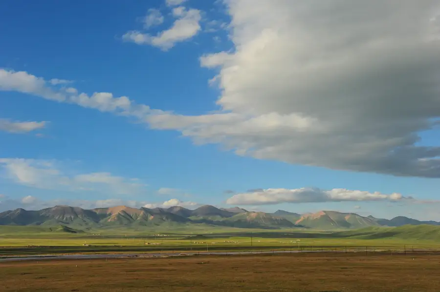
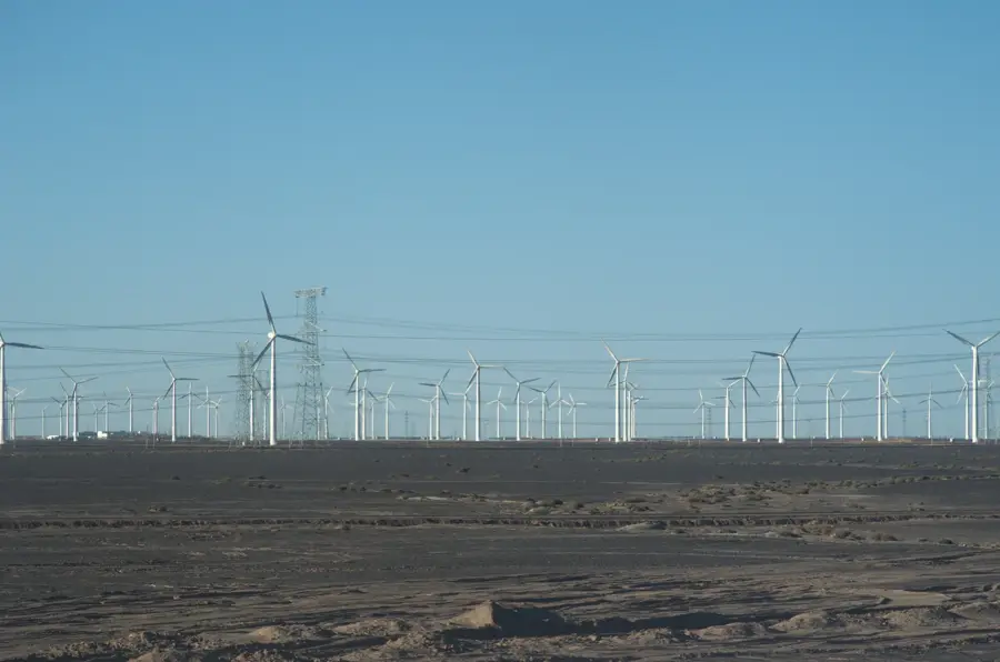
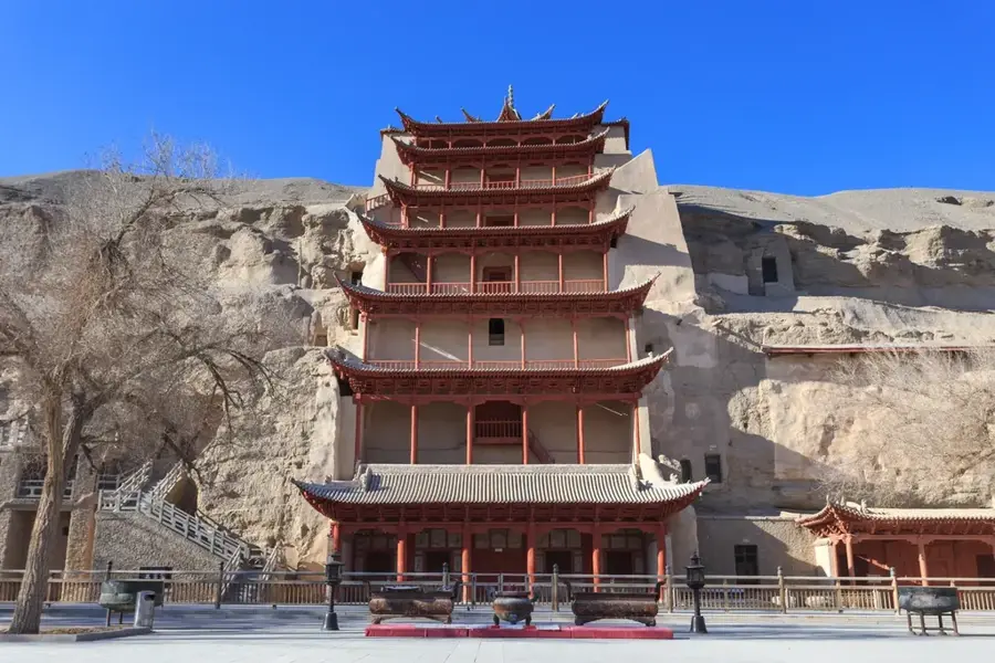
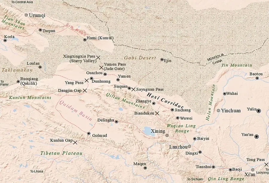
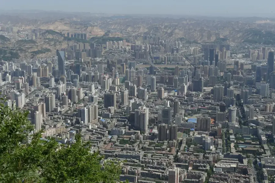
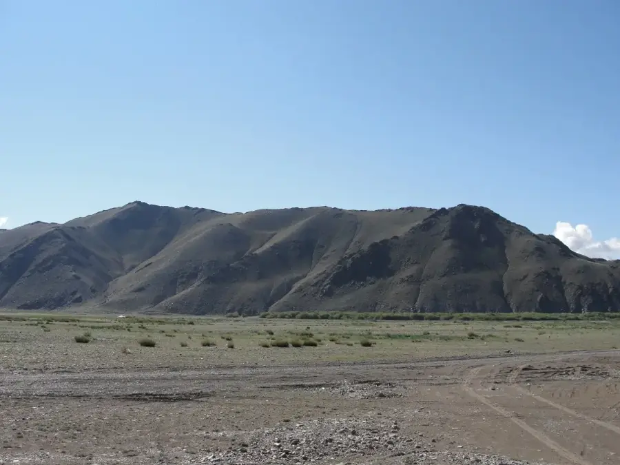
The Hexi Corridor is a narrow, 1,000-kilometer-long plain in Gansu Province, situated between the Tibetan Plateau to the south and the Gobi Desert to the north. Historically, it served as the most vital segment of the Silk Road, providing the primary overland route connecting central China with Central Asia and the West. Geographically, the corridor is defined by the Qilian Mountains, which supply essential meltwater to the series of oasis cities along the route. Famous historical hubs such as Dunhuang, Wuwei, and Zhangye were once bustling centers of trade and significant sites for Buddhist art and culture. Although the climate is arid, sophisticated irrigation systems support the cultivation of wheat, corn, and fruits in the fertile oasis pockets. Today, the corridor continues to be a crucial transport artery, housing high-speed railways and pipelines that link China's western resources with eastern markets. It also features notable remains of the Great Wall, constructed to protect the vital trade route from northern nomadic incursions. In modern times, the region has become a leader in renewable energy, hosting some of the world's largest wind and solar farms.
- Location: China
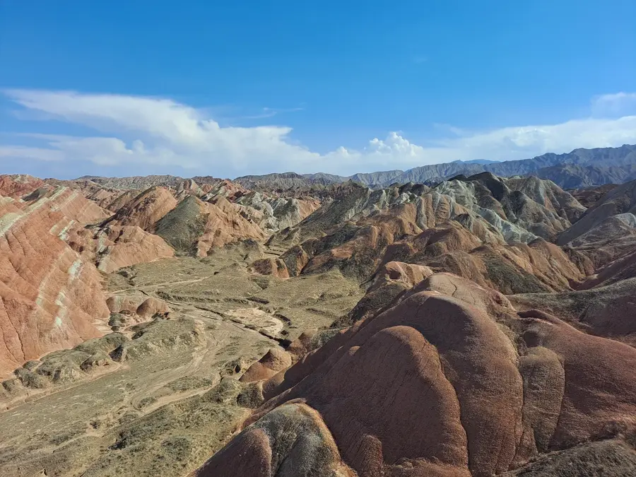
- Nearby: Zhangye Danxia (26 km)
Best time to visit & climate
The most pleasant time to visit is May, Jun, Sep.
| Jan | Feb | Mar | Apr | May | Jun | Jul | Aug | Sep | Oct | Nov | Dec | |
|---|---|---|---|---|---|---|---|---|---|---|---|---|
| Avg °C | -8 | -3 | 4 | 11 | 18 | 24 | 26 | 24 | 18 | 10 | 1 | -6 |
| Rain mm | 2 | 1 | 3 | 5 | 11 | 17 | 22 | 18 | 15 | 4 | 2 | 2 |
📋 Practical info
Geography
Facts
- The Hexi Corridor spans approximately 1,000 km in length through Gansu Province.
- The Mogao Caves near Dunhuang house over 1,000 years of Buddhist history and art.
- The Qilian Mountains to the south provide essential water for the corridor's oases.
- Jiayuguan Pass, built in 1372, is the westernmost gateway of the Ming Great Wall.
- The corridor is a major agricultural hub, especially for seed production and fruits.
- It hosts the Jiuquan Wind Power Base, one of the world's largest wind farm clusters.
Explore nearby
Notable places around
Route planner — Car & Motorhome
Where do you start? We build the route here, with stops and country notes along the way.
© OpenStreetMap contributors · OpenRouteService
Sights nearby
Frequently asked questions
What is the Hexi Corridor?
Why was it strategically important?
What sights are there?
What is the climate like in the corridor?
Can you see the Gobi Desert from there?
Hexi Corridor: where is it located?
Hexi Corridor: when is the best time to visit?
Hexi Corridor: why is it worth visiting?

Nearby cities
History & landmarks
More places